The responding mechanism of wetland ecosystem to climate change is currently unclear due to a lack of long-term records incorporating multiple ecological factors. This paper presents a well-dated and multi-proxy cored record from a natural freshwater wetland developed in a paleo-pingo-related depression on the Sanjiang Plain. The study aims to reconstruct the wetland water-level and vegetational regimes during the past ~6.0 ka BP and discuss the wetland evolution response to the East Asian summer monsoon (EASM) circulation. The results show that a shallow-water lake with hygrophilous herbs developed in the depression with a strong EASM during ~6.0-4.5 ka BP. The paleolake was succeeded by a wetland with a lowered mean water level and an increase in tree cover controlled by the weakened EASM during the past 4.5 ka BP. Such an ecological lake-to-wetland transition corresponds well to the sharp decline of the EASM around 4.5 ka BP which has been well documented in various geological records across the EASM domain. During the wetland developing stage over the past 4.5 ka BP, the water-level and vegetational changes in the studied depression were also closely related to the EASM variations. The strengthened EASM usually generated higher water levels with more hygrophilous herbs around 4.0 ka BP, 3.5 ka BP, 3.0 ka BP, 2.0 ka BP, and 1.3 ka BP. Considering the prevalent EASM climate serving as the predominant water supply for the wetlands on the modern Sanjiang Plain, we suggest the EASM circulation has played a critical role in driving the wetland ecological evolution during the mid-to-late Holocene Epoch. The past 0.4 ka BP is an exception as the local Trees/Herbs ratio visibly increased with the declined water level, while the monsoonal precipitation shows no equivalent shift. The wetland evolution at this stage was attributed to human interference.
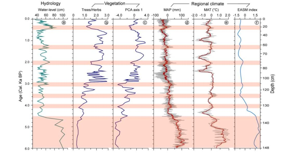
Figure caption: Comparison of the hydrological variation (a), vegetational changes (b and c), and the regional climate variation (d, e, and f) in the studied wetland depression on the Sanjiang Plain. The stacked MAP and MAT curves in (d and e) were calculated from the climate records quantitatively reconstructed by pollen records from five lakes with their locations shown in Figure 1a. The EASM index (f) is referenced from a published paper (Chen et al., 2008). Shaded areas indicate the higher water-level conditions with lower Trees/Herbs corresponding with a the more robust EASM stage during 6.0-4.5 ka BP and six periods centering around 4.0 ka BP, 3.5 ka BP, 3.0 ka BP, 2.0 ka BP and 1.3 ka BP.
This study was financially supported by the National Natural Science Foundation of China (No. 41871098 and 41671094).
Paper download link:https://doi.org/10.1016/j.catena.2021.105332。

 TNU is the only one of its kind in Tianjin that focuses on training high-quality teachers for basic education. It has rich educational resources, excellent facilities and equipment, a strong humanistic spirit, a beautiful and elegant environment.
 TNU has a complete range of disciplines and has outstanding advantages in its majors and has made significant achievements in cultivating talents.
 TNU has a strong research capacity with abundant high-quality research practice bases. They have been approved for over 300 national-level projects and won numerous national awards for outstanding achievements.
 Read all of our latest news and opinion articles, and find out about our upcoming events which can enrich your life at TNU.
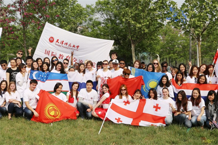 TNU adheres to open education and conducts extensive international exchanges and cooperation. It proactively connects the Belt and Road Initiative, and actively serves the national strategy of "Chinese culture going global".
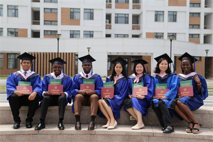 TNU cooperates with countries including Russia, Japan, and South Korea to build four Sino-foreign cooperative education projects, and its scale of international student training ranks among the top in Tianjin.
 TNU adheres to open education and conducts extensive international exchanges and cooperation. It proactively connects the Belt and Road Initiative.